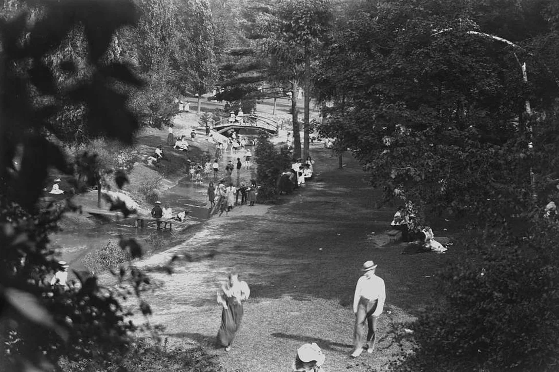
Our ravines in the 19th century
This photo was taken around 1895 when the Vale of Avoca was a destination park. Back then, the horse-drawn streetcar from downtown Toronto on Yonge Street ended at Birch, just north of the CPR tracks, at the bottom of the steep hill up to St Clair. There was then an amusement park in Summerhill, on what was still a large estate, and it linked to the park in the ravine that you see in the photo. As you can see in the photo, it was a popular summer destination, with kids playing in the stream. This was before the stone-block walls were constructed on each side of the stream.
We don’t know when the stone-block walls were built, but we have a photo taken in 1900 of the bridge that used to exist below Summerhill. The rock walls were built sometime before that.
We know that the reservoir was built around 1867, when the City took over what had been a private water company supplying water to Toronto residents. The reservoir was at that time open to the air, not covered until the 1960s, when David Balfour Park was built on top. Back in the late 19th century, the reservoir was effectively an open lake, with a path around it that that connected the Summerhill area to Avoca and the road that went from Pleasant Boulevard down to the pedestrian bridge that was built along with the rock stream walls in the late 1890s.
Bridges across the ravine
We know that there were two bridges across Yellow Creek in the mid-19th century, each capable of one-way traffic of horse carts. The northern bridge, an extension of Rosehill Avenue, went from a road which now is the paved service road down from Avoca across the stream and up on the Eastern side to what is now the intersection of Mount Pleasant and Whitehall. (The road dedication still shows up on City property maps.) The roadway up to Mount Pleasant and Inglewood still exists in the form of a pedestrian trail.
There was also a southern bridge, which connected Summerhill Avenue on the western side to what is still called Summerhill Avenue in North Rosedale. The connection was broken by the construction of the of the CP railway in the early 1880s.
Prior to the railway, Summerhill Avenue angled southwards down the west side of the ravine to where the creek now goes underground, crossed the creek on a wooden bridge, and then went up the other side on what is now Mt Pleasant to the north Rosedale part of Summerhill.
Both bridges were gone by the late 1800s. In 1884, John Moore, developer of Moore Park, built a high-level iron bridge over Yellow Creek, from Pleasant Boulevard in the west to St. Clair in the east. It was replaced by the current four-lane St Clair Bridge in the early 1920s. By then, the only two pedestrian crossings remaining were the existing bridge at the bottom of the service road down from Avoca and the now-destroyed pedestrian bridge below Summerhill.
Did you know that the stream you see beside the Park Drive Reservation road running down to the Don is not Yellow Creek? Yellow Creek is in a large underground pipe below the road, put underground from north of Roxborough down to the Don in the late 1940s. The stream beside the road was constructed in the1960s to handle a stream diverted from the Cedarvale ravine as part of the construction of the Spadina subway. The two streams meet at the foot of Milkman’s Road below Craigleigh Gardens, where they merge and are piped into the Don.